Tuesday, May 29, 2012

Half Dome, 05/25/12

May 25, 2012: Today was opening day on Half Dome. The National Park takes down the cables each Colombus Day and puts them back up late May or early July depending on snow conditions. Today, May 25th, was opening day 2012. I hadn't planned on hiking Half Dome as part of this trip, but after summiting Clouds Rest the prior day the idea grew on me. The big question mark for the day would be the weather. The day prior I had it good for hiking Clouds Rest, 50 degrees, light winds and clear. The forecast today was a 60% chance of snow, 1-3 inches, a high of 30 degrees and 15-20 mph winds, oh and the chance of a thunderstorm after 11:00 am. I did not want to hike the polished granite of the Half Dome Cables when wet and or icy and getting hit by lightning didn't sound like much fun either. I went to sleep the prior night with a lot of questions about the weather and my sanity. I decided to wait until 0330 the day of the hike and see what the sky looked like.......
 
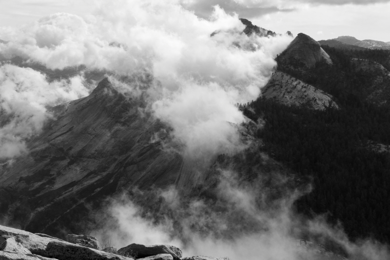
No need to wait for the alarm, I was already awake at 0330. I took a look around and to my joy, the sky was clear in all directions and there was no wind, lets do this. I did the morning chores but this time I had to break down my camp as quietly as possible, I am sure my neighbors were sick of me after two days of this. I moved my truck to the Half Dome Lot and started my trek at 0430. It was much colder this morning than yesterday, but it was nice uphill hiking weather. I didn't see anyone for a couple of hours, not until Little Yosemite Valley. The sky was still clear as day broke, a very good sign. I powered my way up to the Half Dome/JMT junction in two hours forty minutes. As I started to climb the hill to the sub dome, my quads clued into what I was doing and started to disagree with my plans. Time to take a little break to re-fuel. As I continued onward I noticed two things; one being no ranger to check permits, maybe they slept? The other was wispy, swirling clouds on the north side of Half Dome. One minute you could see it, the next it was enveloped. I watched this for a moment making sure these were not storm clouds aka lightning or rain/snow. I decided that it was safe to proceed and made my way slowly up the sub dome.
 
I arrived at the base of the cables at 0805 and had them all to myself. There were a couple of people meandering about at the top of the cables, but nobody was in my way going up. Could I possibly get up the cables with no interruptions sans the occasional photograph??? Later in the season there will be a pile of gloves people can pick though to save their hands from the cables, but being today was day one of the 2012 season, there were none. Lucky for me I had brought an extra older pair to use and its a good thing I did, the cables were freezing, even with gloves on, my finger tips were numb. I got into a steady rhythm and topped out on the summit of Half Dome at 0815. The wispy clouds made for great photos. I took as many as I could before the clouds engulfed the summit. It was very brisk on top and I took refuge in a ring of gigantic boulders but I was still chilly. I walked over to the southern section of the dome to have a look, then made my way back to the cables. I was able to make it down quickly and safely. Back at the sub dome I ran into about twenty five people. Most were overnighters from Little Yosemite Valley. The clouds had dissipated and the summit and cables of Half Dome were clear, made for great photos. I made it a point to get back into the trees before taking a needed twenty minute siesta. I was tired and my feet were getting tired. The building clouds blocked the suns rays and it got cold, time to go.
 
I made it to the top of Nevada Fall under darkening skies, at this point it started to snow. I could still see some of Liberty Cap, but Half Dome was shrouded in clouds. Glad I was headed down. Funny thing was, there were people heading up with the notion to climb Half Dome. I gave the first couple of people the advice to stay away from lightning prone granite with slick/wet footing. After the first few, I just smiled and told everyone good luck, have fun. I must have passed a dozen people wanting to climb Half Dome during a spring snowstorm between Nevada Fall and the trailhead.
 
I arrived back at my truck at 1245, good times. I made it over to Yosemite Village to grab a Teriyaki Turkey Burger with Sweet Potato Fries (super good), get some gifts and take a shower before the long drive back home. I accomplished my goals and drove out of the valley in a light snow, it was even accumulating at the Glacier Point turnoff, so pretty. I found out that the National Park closed Glacier Point Road and Tioga Pass, I made it out just in time. The drive home was nice and uneventful, I made the best of my unplanned Yosemite week, sometimes plan B is the better option, good times.
 
Swirling Clouds Engulf Half Dome

Heading Up

Mixed Views Into The Valley

Clouds Rest Through The Clouds

Yosemite Valley From The Summit

Mt. Lyell & Mt. McClure In The Distance

Looking At Half Dome From The Southern Part Of The Dome

Looking Up While Heading Down The Cables

View Of The Cables

Great Success :)

Whispy Clouds Help The Black & White Photo Stand Out

Close Up Of The Summit
 

Monday, May 28, 2012

Clouds Rest: 05/24/12

May 23, 2012: I took off a week of work to do some Sierra spring time backpacking and hiking. I was all packed up with my overnight gear and headed to Horseshoe Meadow to do some multi day peak bagging. As sometimes happens, mother nature altered these plans. Big winds were forecast in the high country, 50-70 MPH winds :(. On top of that was a large cold front coming in to drop temperatures 20-30 degrees below normal and bring in some snow. Middle Palisade, Joe Devel, Pickering, Langley would all have to wait. I didn't want to let the week off go without some kind of climb to I got out the maps and weather forecasts. My best bet would be the lower elevation Yosemite peaks such as Clouds Rest, North Dome and perhaps Half Dome. The winds wouldn't be as bad, 20-30 MPH and no snow until Friday afternoon. I had never climbed/hiked Clouds Rest so off to Yosemite I went, well almost. This was the Memorial Day holiday weekend in one of the most popular National Parks. I checked online and there were no campsites available in the entire park. Sleep in my truck you say, well, Yosemite has one of the strictest anti sleep in your vehicle enforcements around. So the plan was to drive up and hope for the best, a cancellation, no show or spot in one of the walk in campgrounds. Didn't have a good feeling in my gut about this, but it was my best option, so I packed up the truck and left into the unknown. 

The drive to Yosemite was a stressful but fast drive due to the uncertainty of where I would be sleeping tonight. If I was to day hike Clouds Rest from Happy Isles, I would need to start at dawn and get a good nights rest. I really didn't want to drive all the way to the valley floor, get shut out and drive the hour and a half back to Oakhurst or beyond and pay $100+ for a quick nap. I arrived at the south gate at 1500 and was immediately greeted with a big red sign saying "All Park Campgrounds Full". I proceeded with even less optimism and decided I would stop at all the sites to see if there were any cancellations. Wawona was first up and as advertised, full. I then drove to the valley floor and checked with Camp Four, no luck. Onward Curry Village to check out the "Pines" campgrounds. They were all full, nothing. Started to look grim and bleak. Thoughts of abandoning the entire trip started to creep into my psyche. I was told at Upper Pines to check with the main campground reservation office in Curry Village to see if their was anything last minute. I arrived at the office with my tail between my legs, what was I thinking, trying to get a campsite last minute Memorial Day week at the busiest National Park in the land. Took a deep breath and crossed my fingers. I was told by the lady at the office the same thing I had been told everywhere else, nothing available. Just as I was getting ready to call it quits a gentleman came out of the back and told me one site just opened up at Upper Pines. The site was for two nights. I excitedly took the spot, didn't really care where it was, a campsite was gold. I paid the fee and was off to set up my camp, good feelings quickly replaced the doom and gloom, I got extremely lucky :)  

Now I could turn my attention to the task at hand, our the task for tomorrow morning. Clouds Rest is a gigantic granite slab that towers over all of Yosemite Valley, even Half Dome. It is at elevation 9,926'. There are essentially two standard ways to climb it, the much easier version is to start at Tenaya Lake at roughly 8,000'. The other version is to start at Happy Isles, elevation 4,035'. I planned to do the latter, why not. I set up my camp aka home for the next few days and packed up my backpack for the morning. I then headed over to Yosemite Village to get some dinner. The village is a great place to hang out, lots of things to do; eat, shop, library, eat, shop, all that with a backdrop of Yosemite Falls one way and Half Dome the other, truly magical place. I had a Turkey & Bacon Club and an ice cream for dinner. Made it back to camp and hit the sack. Set the alarm for 0430, what a day. 
 
Alarm went off at 0430 and I eagerly made my way through the pre dawn chores: eat an oatmeal/peanut butter breakfast, change into hiking clothing, put on contacts and check campsite for potential bear problems. Once complete I was on my way from my campsite at 0530. The weather was great at this hour and would remain so all day, the high winds that were forecast never materialized. I did not have to use a headlamp as the early morning light from the east was sufficient. I made it up to Nevada Fall in good time and took my first break. I hadn't seen a single person so far, very unusual for such a busy trail but it made sense, the cables for Half Dome weren't due to go up until tomorrow, the calm before the storm in more than one way. Before too long I was at the Clouds Rest/JMT junction and made a left onto the trail. It climbed rather steeply for most of the duration to the summit. The views would become grander and grander the higher I climbed. I made it to the summit of Clouds Rest, elevation 9,926' at 10:25. The views were amazing in all directions. Half Dome looked great from this perspective. The skies were clear and I could see Mt. Lyell, Matterhorn Peak, Cathedral Peak, Mt. Clark, Half Dome, Yosemite Valley, Tenaya Canyon, Mt. Dana, Mt. Conness among others. I enjoyed my lunch with the beautiful scenery and weather, life is good.
 
After an hour on top I made my way back down the trail to my campsite. The trip ended up being 22.1 Miles with 6,000' of elevation gain. A good day in the mountains. I arrived back to camp at 1500 hours and had to make a decision about tomorrow's plans. The very latest weather forecast called for a 60% chance of snow at the 7797' level, the temperature was going to drop twenty plus degrees. It looked like the timing of the storm was for late morning. So my choices were Half Dome or Yosemite Falls to Snow Creek Falls with a side trip to North Dome. I decided to set my alarm for 0300 and see what the skies looked like, clear skies and I would go to Half Dome, cloudy skies and I would go to North Dome...........
 
First Light

Half Dome Through The Trees

Snow Plants

Yosemite Valley From Summit

Self Portait w/ Half Dome Backdrop

Half Dome

Matterhorn Peak & Tenaya Lake

Black & White Yosemite Valley

Half Dome, Liberty Cap & Nevada Falls

Yosemite Falls

Half Dome View From Upper Pines Camp
 

Wednesday, May 9, 2012

Mt. Whitney Loop, Mountaineers Route To Main Trail


May 8, 2102: Had a few days off and wanted to do a Sierra spring climb. Went over a bunch of ideas; Mt. Dade, Mt. Agassiz, Mt. Mallory but decided to day hike the Mountaineers Route on Mt. Whitney. Thought about an overnighter up to Iceberg Lake, but changed my mind to a day hike last minute. 

Headed to Whitney Portal Monday afternoon to get one nights rest before the climb. Got to the Portal and found it mostly void of people. I met one guy who was traveling cross country on his motorcycle and wanted to climb Mt. Whitney as his California stop, my kind of guy. Had my Subway dinner and bedded down at 1900 hours. I fell asleep fairly quickly. I was woken up abruptly an hour later by fierce winds. The flapping of the tent made for a restless night of sleep, at least I was getting that mountain oxygen into my system. The alarm sounds at 0300 and I gingerly packed up my gear, had a monster and pop tart for breakfast and was off on the trail. I scouted out the route to Lower Boy Scout Lake two weeks prior so doing it the headlamp this early morning was stress free. I made it to the lower lake at 0530. Last year when I did the Mountaineers Route it was all snow from here to the summit, well that was last year. The snow makes route finding a breeze, just straight up. I tried to pick out the best route to Upper Boy Scout Lake, but ended up to high up on the talus field. Instead of correcting my course I decided to visit the blue icefall that comes down from Girl Scout Lake. So magnificent blue, glad I checked it out. Problem now was getting back on route. Do I want to backtrack or bushwhack through some willows. I opted for the later and made it incident free. 

Made it to Upper Boy Scout Lake in good time and more importantly, I felt good. Two weeks prior I day hiked Whitney and was blasted by a headache at 14,000'. Though I was only at 11,300' so far, I felt good. The climb now was over slabs to the base of the cliff leading up to Iceberg Lake. Still no need for crampons. I decided to take the waterfall route up to Iceberg Lake. I had planned on getting water from the edge of the lake, but no luck, it was frozen solid, I even walked out on it a few feet and tried making a hole with my ice axe, nothing. So now it was plan B for water: make slushy snow water with my existing water and hoped it melted. Bummer. I had some lunch and geared up for the climb. Ice Axe, Crampons, Sunscreen, Helmet....Lets go. 

I decided to take the main chute from the beginning as opposed to the southern alternate start. The main chute looked like the better snow climb down low and I was right. The snow was beat up pretty bad from previous ascents and glissades from past climbers. It hasn't snowed in weeks so the snow was a mix of giant steps and icy glissade tracks. The snow was very firm which made the climb relatively fast. Three quarters up the chute I had to remove my crampons as the snow ended and the loose rock began. I tried to stay to the right of the chute where there is solid rock. Before too long I made it to the top of the chute and saw the grand Sierra view. Mt. Russell, Mt. Williamson, Mt. Barnard, Mt. Brewer to name a few. A few more feet west brought me to the final four hundred. It was a mix of rock and ice, pretty standard. The first few moves are the most difficult then a steady class three. I made steady progress a couple of hundred feet up before putting on crampons to finish off the remainder of the climb. It was a very icy snow and I was careful of my foot placements, always thinking about the consequences of a fall here. 

I topped out on Mt. Whitney for the eightieth time and for only the second time I had the summit all to myself. It was breezy and really cold so I hunkered down amongst the rocks for shelter and had some lunch. Great feeling to have finished the Mountaineers Route. I put out my Spot message to Judy letting her know I was safe and sound on the summit. I soaked in the views, I will never tire of the views. I always feel so small in the world and realize there is a far more powerful entity at work while in the mountains and the summit of Whitney without a soul around for miles really hits the spot. 

I had decided earlier to take the Main Trail back to Portal, a grand Whitney loop. I set off the for the five hour descent at 1230. Everything went as expected, the slope down from Trail Crest to Trail Camp was too icy to glissade so I plunge stepped it. And I am happy to report no Grouse sightings, even though I did hear them. Made it back to my truck safe and sound at 1730, a quick 13.5 hour hike. Great Day on Mt. Whitney.....till next time :) 

Stats: 14.2 Miles and 6500' of elevation gain

Sunrise

Alpine Glow

Waterfall Ice

First View Of Mt. Whitney

Feeling Good

Mt. Whitney

All Geared Up To Climb The Couloir

Looking Up About Halfway

Looking Back Down

View From The Notch

On The Summit, It Was Cold, But Worth It

Looking At Iceberg Lake, Where I Started The Couloir


Mt. Langley & Pinnacle Ridge

The Kaweahs

Coming Down The Main Trail

First Tree I Have Seen In Hours

Topo Map Of My Route

Sunday, April 29, 2012

Mt. Whitney via Snowy Main Trail


April 28, 2012: Work schedule and weather finally aligned for a spring climb in the Sierra Nevada and why not go for the highest peak; Mt. Whitney. 

I left Simi Valley for Lone Pine at 0730. Perfect drive, no issues and good views, well past Mojave there are good views. Arrived at the visitors center to pick up my non quota permit at 11:00 am and headed up to Whitney Portal. The view of the Sierra Crest from Whitney Portal Road is grand. Mt. Whitney, Mt. Langley, Lone Pine Peak (gets mistaken for Whitney by a lot of 395 motorists) and Mt. Williamson to name a few. I set up a quick camp at the backpackers campground and explored the Portal. There was a powerful wind storm that affected all of the Sierra Nevada on November 30, 2011 and this area was hit hard. A large tree fell right onto the site I used last Labor Day at the campground. Gave me the chills.  The crews have done a remarkable job of cutting and clearing the downed trees. While I was there, Doug Sr. (who owns and runs the Whitney Portal Store and Hostel) was pulling downed trees out of the trout pond with a truck. 

I decided to do a warm up/exploratory hike up the North Fork of Lone Pine Creek. I had been up it before, but it was pitch black and by headlamp, I wanted to see it during the daylight hours. I am attempting Mt. Russell as an overnight trip in June so this was an exploratory trip as well. Got started on the trail at 1330 and made good time to the Mountaineers Route cutoff. From there it is a steep uphill on the north side of the creek. Soon I crossed to the south of the creek then back across to the south. Progress up the canyon is blocked by thick willows and brush. To keep going one must climb the class three Ebersbacher Ledges. Being on the route before really did help. Though it was dark, I remembered the moves and route. Once past the ledges it is a easy walk up to Lower Boy Scout Lake. The views in all directions were great. I was last here Memorial Day weekend and what a difference. The snow is significantly less. The route to the upper lake is mostly rock now. I took some mental notes for my Mt. Russell climb and headed back to the Portal. I got there in time for a delicious burger and fries then hit the sack at 1930. 

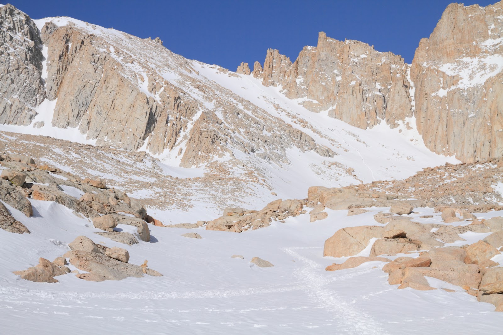
After a restless tossing and turning night of mediocre sleep I was awake at 0330. Packed up camp, made breakfast and had last minute prep and checks. I was on the trail at 0430. I didn't see any other day hikers for some time, for the most part I was on my own for the first few hours. Perhaps the overnighters were on to something. The 2012 winter season is the sixth worst since records were kept according to the CDEC and evidence of that is all around. I didn't have to put on any snow gear until 11,000'. (Just last year the trail wasn't snow free until early July.) I strapped on the crampons and headed up towards Trail Camp. I felt good despite the restless night of rest and little acclamation. Once at Trail Camp I found out where all the people were hanging out. Trail Camp was a zoo, it looked like a mid July crowd. I could see the conga line of people heading up the slope to Trail Crest. Well, I had an objective, catch and pass as many as possible (this genius plan of mine would cost me later). I made good time up the 1700' slope, the line of people kicked in a nice boot path that was easy to follow. I made it from trail camp to trail crest in 1:30 and I was able to pass nine people. Good times so far. The view west from Trail Crest is one of the best there is, I am always impressed, it will never get old. I took off the crampons and walked across the soft snow to the JMT junction. I took a small break and had a snack. At this point I realized how little water I had consumed to this point. I continued up to the base of Mt. Muir and took another break. Why was I having to slow and stop so much? I continued on to the 14,000' level and abruptly stopped. I was feeling terrible. Headache, fatigue, thirsty. Wow, I was suffering the effects of Altitude Sickness. I took a longer break and tried to figure out how this was happening to me. Well, it had been seven months since I was at this altitude, I was not well rested, dehydrated and did not pace myself very well. I drank what was left of my water and tried to refill with snow, but that was not working out very well. From here to the summit I took it really slow. I would count out one hundred steps and rest. The headache was zapping my strength, Excedrin wasn't helping at all. I told myself I could continue as long as dizziness, nausea or light headed occurred or started. After what seemed like forever I arrived at the summit at 1245. I contacted my wife via the Spot Connect to tell her I was on the summit and safe. I took some photos and ate some lunch. Here was another mistake. I only brought candy bars and junk food. Snickers, Pop Tarts, left over Easter candy. Though tasty, it wasn't supplying lasting nourishment to fuel this grueling climb. Simple carbs weren't enough. The views were enough to make this seventeenth summit worth the effort. All those mountains to climb and Whitney looking over them all. To the north were a couple of fourteeners I am to climb this summer, Mt. Russell and Mt. Williamson.....hopefully.

After a half hour to rest and recuperate I headed for the long journey back to the Portal. As soon as I started the headache made itself known again. It would accompany me the entire way down unfortunately. I made my way back to Trail Crest in a very methodical pace, the headache was terrible and I was still low on water. What a pain in the arse. At Trail Camp I had a decision to make. Plunge step down the 1700' slope back to Trail Camp or Glissade. This slope has been the end of a few hikers time on this earth because of out of control glissading in un ideal conditions. The slope was in great shape going up and appeared to be so now. This slope loses the sunlight very early in the day and can turn into an ice rink in no time. I have successfully glissaded the slope in the past and after careful consideration decided to give it a go. Out came the ice axe and water proof clothing and off I went. The snow was actually too soft for a swift glissade but I managed good time down the slope. If I ever needed to slow down I just leaned back and let the snow sluff build up and stop me without the axe. Very safe condition. At Trail Camp I took a nice long break, got some water and another snack. Headache was still with me, I was hoping it would subside with the elevation loss, but it did not. From there it was retrace my steps back to dry trail at Mirror Lake. Problem was, the snow was softening up and postholing was a problem. After avoiding the land mines I made it back to nice dry trail and it was supposed to be smooth sailing to the truck, but......

A grouse is a chicken looking bird that loves to stalk and attack me on mountain trails. I had a run in with one on the Meysan Lake trail a couple of years ago. That one tried to scratch out my eyes and end me. I narrowly evaded doom. Back to now. I was at the 9300' level on the trail when I heard the eery call of the Grouse. It is a deep moan that echos throughout the forest. Right in front of me were two females. Grouse are fearless and are not impressed with humans. I clacked my poles together in hopes of scaring them away, that tactic works on Bears and Coyotes, but not Grouse. They are crazy, angry chickens. These two females were attacking each other and not me for the time being. I would normally try and give them a wide berth but I was in a section of trail with a drop off on the right and thick brush to the left, nowhere to go. They continued to fight each other right in the middle of the trail. I tried throwing rocks in their direction. That did nothing to them, they just looked over and made a terrible groaning noise. I decided to put on my sunglasses, got out my ice axe and ran right through them. I was worried they would take flight and scratch out my eyes. I know this must sound funny but I was truly scared of these terrible critters. Somehow I made it through the gauntlet to the other side. A normal wild bird would be terrified of a six foot human running at them with an ice axe, not these two, they didn't even budge as I ran by. That whole event took about ten minutes, mostly me trying to get them to move. I quickly moved away from the drama and quickly ran into the bid bad male Grouse. This thing had his feathers all ruffled up, his tail feathers looked like a Turkey and his neck feathers were brilliant yellow and orange and he was pissed. He made an even more disturbing sound. WTF. I wanted nothing to do with this crazy bastard so I cut some switchbacks hoping to get away from them but ran into two more. I went off trail some more to evade capture and certain death by crazy chicken. I must have come across a nesting site. Next time I will be better prepared, time to make friends with an El Pollo Loco chef who hikes. I made it back to my truck at 1830, cleaned up and headed for Subway. After dinner I drove all the way back to Simi Valley. I felt good after dinner and made it back safely. What a weekend. 


This trip was an eye opener for me. I made a lot of small mistakes that added up to cause my feelings of not so well being. I made a list below. I consider myself experienced but humble. Mt. Whitney taught me a valuable lesson today. Not only do you have to prepare and train for snow travel, self arrests, proper crampon use, emergency shelters, first aid, the list goes on and on, but you also have to take care of the smaller things such as diet, hydration, rest, pace. 

Mistakes/Issues: 
Restless Sleep At Altitude: Not much can be done about that, just need to be at elevation longer, can't always afford that luxury. 
Poor Trail Diet: (Candy Bars=Simple Unsustainable Carbs, No Complex Carbs). Need to balance out the candy with some sustainable energy sources. Peanut Butter, Pretzels, Honey, Nuts, Dried Fruit. 
Waiting For Warm/Burn Feeling To Put On Sunscreen: I admit it, I do not like sunscreen. Goes back to my fishing days, don't like the slimy goey feeling. But it is a necessity up high. I usually wait too long to apply it. I need to apply it much earlier in the day. 
Going Fast Up Trail Crest Slope: I made the critical mistake of racing up the slope to pass people. Instead of taking my time and resting along the way, I stormed up the most taxing section of the entire trail. 
Not Enough Pack Off Rest Breaks: There are two kinds of breaks, quick pack on breaks and pack off breaks. I needed to take more pack off breaks to not only rest, but to acclimate to the altitude. 
Not Enough Water, Waited Too Long To Hydrate, Damage Was Done: By the time I really needed the water, there wasnt a water source. I needed to fill up at Trail Camp. Needed to take the time to hydrate which I did not. 
Not a fan of the Grouse aka Angry Fearless Chicken :/

Here are some photos. All can be viewed here:  http://calicokat.smugmug.com/Hiking/Sierra-Nevada/Mt-Whitney-April-2012/22697072_KtBmL7#!i=1819651925&k=zjn9fxv
First Morning Light

Alpine Glow

Looking Towards Trail Camp

Having Fun So Far

Following The Boot Track

Slope To Trail Crest

Looking Down From Slope

At Trail Crest

View West 

Mt. Brewer

View From The Windows

Mt. Hitchcock

View North 

Myself, Headache And All On Whitney For The 17th Time

Mt. Tyndall & Mt. Williamson

Mt. Randy Morgenson

Frozen Tarn Melting 

View East On Way Down 

Topo Map